You already have Scout
Keep every check
on every listing.
Subscribe and your badge shows everything again: the flood grade, past floods and overland flow, slope, road busyness, zoning, heritage, bushfire, the nearest station, development applications and the price estimate.
- Unlocks on this computer straight after checkout - nothing to paste
- Up to 3 devices, Scout for mobile included
- $15 a month including GST, cancel any time from your account page
Zoning, flood, bushfire, heritage and terrain in one PDF report, from $9. No account needed.
Get the report for this property ›Chrome extension + mobile app · realestate.com.au · Queensland, NSW & Victoria
Flood, zoning and elevation on every listing
before you book the inspection.
Scout reads the address of every realestate.com.au listing as it loads and adds a small badge: council flood risk and flood history, how high the lot sits against the street, zoning, heritage, bushfire, road busyness, a price estimate and, in Queensland and New South Wales, slope. Rule out the wrong houses while you scroll.
Full badge free for 5 days of browsing - only days you use Scout count - no card, no account, nothing to paste. After that, elevation stays free and the badge still names anything flagged.
On a phone? Open Scout for mobile →
Not every check runs in every state: overland flow is Queensland and Victoria, and development applications are Queensland only. Spend your Saturdays, and your building-and-pest money, on the ones that deserve it.
Try it on any Queensland, NSW or Victorian address
Free, no sign-up. The same flood, elevation, slope, zoning, bushfire, heritage and transport result Scout puts on every listing.
15 Queensland councils, 127 NSW councils and all 85 Victorian councils - full list.
 Inspection Sat 10:00am
▦ 1 / 24
♥
Inspection Sat 10:00am
▦ 1 / 24
♥
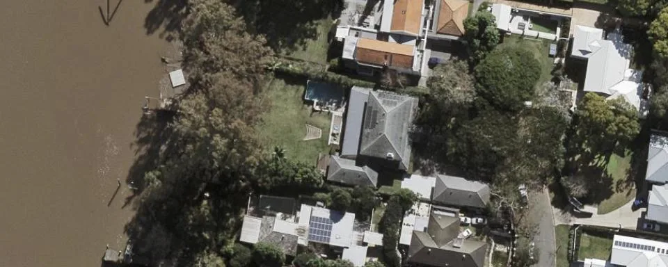
Mapped in the council flood overlay. Flooded in January 2011 and 1974.
 ▦ 1 / 31
♥
▦ 1 / 31
♥
 ▦ 1 / 18
♥
▦ 1 / 18
♥
 Auction Sat 24 May
▦ 1 / 27
♥
Auction Sat 24 May
▦ 1 / 27
♥
Counts from Scout’s own lot table, built from council and state flood overlays, the Queensland Government elevation model, the NSW Spatial Services elevation model and the Vicmap elevation model. Made by LayeredGeo, the team behind geotechnical and planning reports for engineers and builders.
The listing won’t tell you. Scout will.
Property portals show you photos, bedrooms and a price guide. The things that actually change what a house is worth to you - and what it will cost to own - live in council mapping nobody checks for every listing.
The photos hide the 2011 flood line
A freshly painted Queenslander on a quiet street can sit a metre below its neighbours in an overland-flow path, or a few hundred metres from a river that has been up twice in living memory. The council flood overlay knows. The listing does not mention it.
Checking properly takes ten minutes a house
A FloodWise report here, the council planning scheme there, a terrain map for elevation, another tab for a price guide. Times forty listings on a Tuesday night. Nobody does it for every house, so the shortlist ends up built on photos and gut feel.
By the time you find out, you’ve paid
Flood, slope and heritage controls tend to surface at the building-and-pest or the solicitor’s searches: after the inspections, after you have fallen for the place, sometimes after the contract. That is the expensive moment to learn a house floods.
Scout checks every listing as it loads. The houses worth your weekend stand out. The rest you scroll straight past, and you never spent a cent finding out.
Three streets. Very different stories.
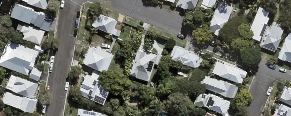
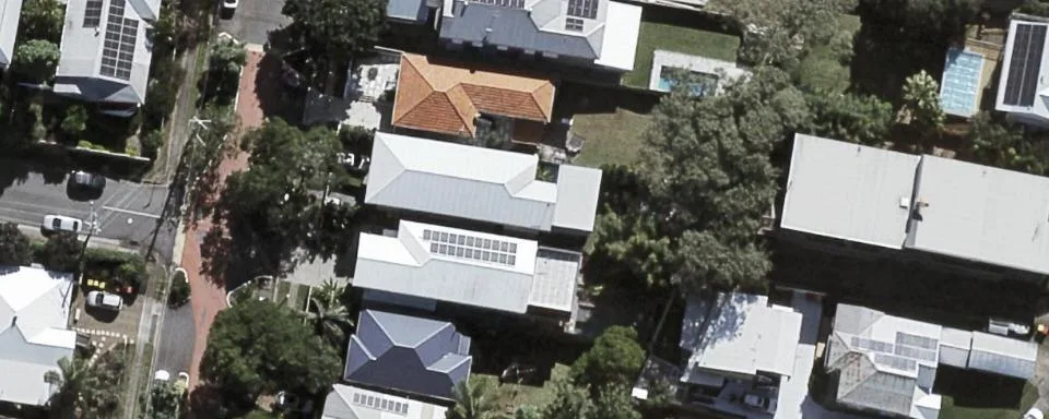
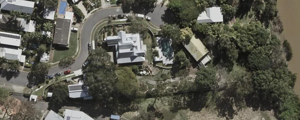
Three real Brisbane houses with their real Scout data, straight from council flood mapping and Queensland Government terrain data. Every one of them photographs beautifully. Only one of them went under in 2011 - and it is not the one you would pick.
Hover the pills - they explain themselves, just like in the extension.
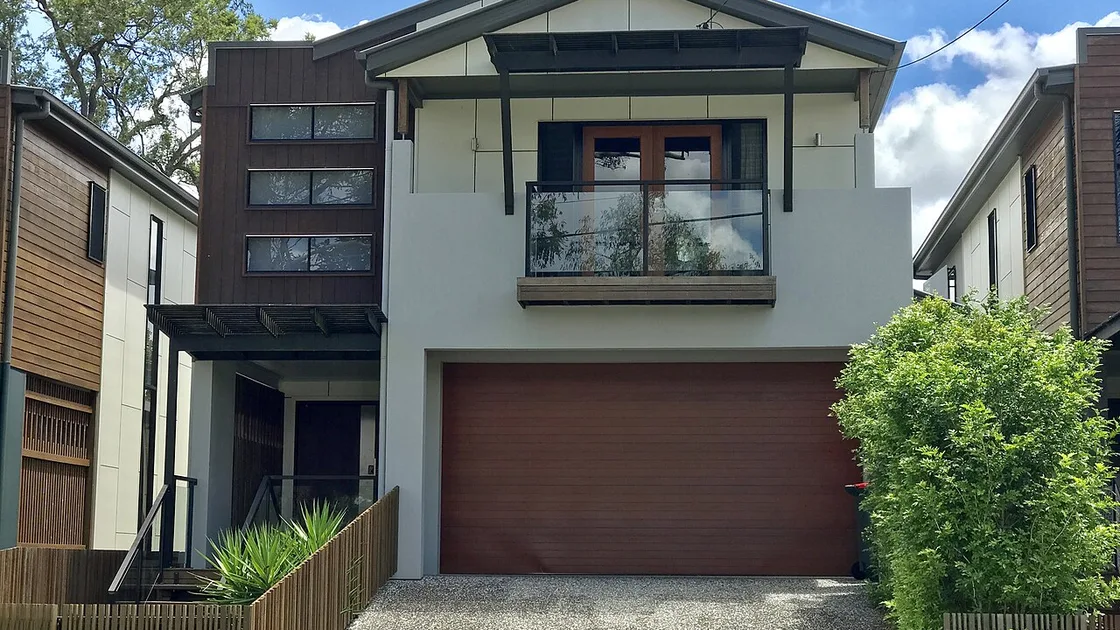
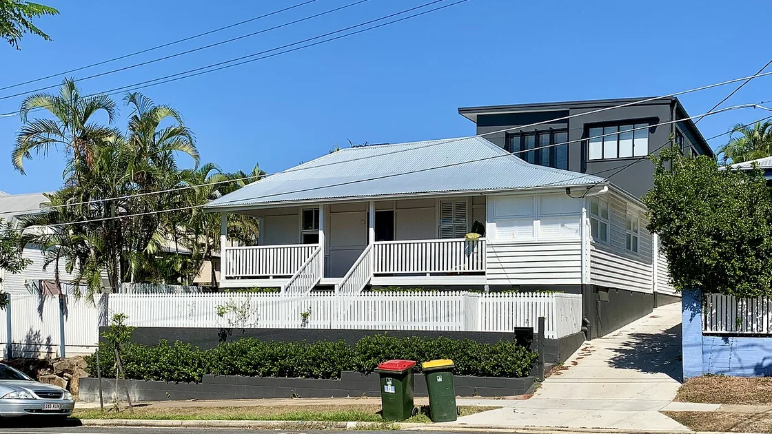
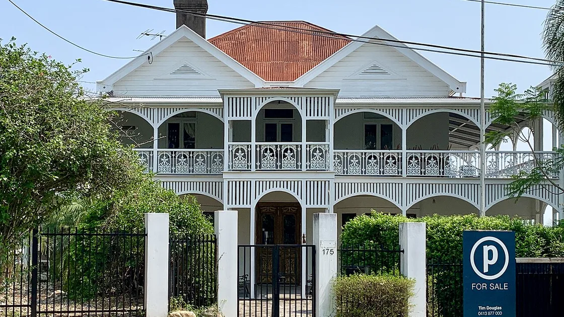
Photos: Kgbo & Chris Olszewski, Wikimedia Commons, CC BY-SA 4.0
Twelve checks on every listing. Each one answers a real question.
Hard data first, quiet screening underneath. The badge only speaks up when something is flagged; everything else folds into a small “clear” chip. Hover any pill in the extension and it explains itself.
Flood risk
ScoutDoes this house flood? Council river, creek and storm-tide flood mapping resolved to the actual lot and rated the way the council rates it - High, Medium, Low - not a suburb average.
Council and state flood overlays, 100 councilsFlood history
ScoutHas it actually gone under? Whether the lot sat inside the recorded extent of the 1974, 2011, 2017 or 2022 floods. Mapping says what could happen; history says what did.
Council and state historic flood extentsOverland flow
ScoutDoes water run across the block in a storm? Council overland-flow mapping: the flooding with no creek in sight that catches buyers on perfectly ordinary suburban streets.
Council overland flow overlaysElevation vs the street
FreeWhere does the water go? Height in metres AHD and, more usefully, how the lot sits against the surrounding neighbourhood. A metre below the neighbours is where runoff ends up; five metres above is a view and natural drainage.
QLD Government and Vicmap elevation modelsSlope
ScoutWhat will it cost to build or extend? Gentle, moderate or steep, as a percentage. Steep means retaining walls, split levels, drainage design and quotes that only go one way. Queensland and New South Wales only - Victoria does not publish a lot-level slope we can stand behind.
Slope across the lot from state elevation models (Queensland and NSW)Road busyness
ScoutIs it a quiet street? Every frontage scored from quiet local street to main road, so you do not discover the traffic at the open home, or after you move in.
Road network classificationZoning
ScoutWhat can be built here, and next door? The planning zone in plain words: low density, character, medium density, emerging community. It decides whether a granny flat, a subdivision or a block of units is on the cards.
Council planning scheme zonesHeritage & character
ScoutCan I knock it down or lift it? Heritage listings and traditional building character overlays, which restrict demolition and major alterations and shape what a renovation is allowed to look like.
Council heritage and character overlaysBushfire
ScoutWill it affect insurance and build cost? Bushfire prone area overlay on the lot. It changes construction standards, insurance premiums and what you are allowed to build.
Council and state bushfire overlaysTransport
ScoutCan I walk to the train? The nearest train station or ferry terminal, with the distance, whenever one is within walking range. Silent when there is not.
TransLink and PTV networksDevelopment applications
ScoutWhat is going up next door? Recent development applications on the lot and the lots beside it, with a link through to the council file. The townhouses behind the back fence, before you buy. Queensland councils only.
Brisbane City Council PD Online (Brisbane listings)Price estimate
ScoutWhat is it actually worth? PropTrack’s automated estimate and range on every listing in the extension, including “Contact agent”, “Offers over” and auction campaigns that never show a number.
PropTrack via property.com.au (Chrome extension)What you would otherwise do by hand
Everything on the badge is public information. The difference is that Scout does the lookup for every listing, every time, while you keep scrolling.
| Question | Doing it yourself | With Scout |
|---|---|---|
| Does it flood? | Order a FloodWise report or open the council flood map, one address at a time, and interpret the overlay yourself | Rated on the badge, with the flood history years |
| How high does it sit? | Squint at contour lines in a state terrain viewer, or judge from the kerb on inspection day | Metres AHD and metres above or below the neighbours |
| Zoning, heritage, bushfire? | Council planning scheme mapping, three overlay layers, a lot-plan lookup and a PDF code | Zone named in plain words; overlays only speak up when flagged |
| What is it worth? | Another tab, another search, for every “Contact agent” listing | Estimate and range on the card (extension) |
| What is planned next door? | Council DA tracker, searched by address, after you have found the lot plan | On-site and adjacent applications, linked |
| Time per listing | Several tabs and a good ten minutes, so it only happens for the two or three you already like | None. It is there when the listing loads, for all forty |
Scout is screening, not a substitute for the searches your solicitor runs before settlement. It is what tells you which houses are worth running them on.
Built for the way Queenslanders actually house-hunt
Forty tabs open on a weeknight, three inspections on a Saturday, and a group chat asking “but does it flood?”
Shortlist with confidence instead of anxiety
You have one deposit and no appetite for a surprise. Scout makes the 2011 flood line, the overland-flow path and the steep block obvious on the search results page, so the places you inspect are the places you could actually buy.
- The free badge still tells you when a listing is flood-flagged
- Plain-English tooltips, no planning jargon
- Share a free address check with whoever is helping you decide
Know what the block will let you do
Lifting a Queenslander, adding a deck, going up a level: slope, character overlays and heritage listings decide whether the plan is a weekend of sketches or a year of town planning. See them on the listing, not in the architect’s first invoice.
- Slope and elevation against the neighbours
- Character and heritage controls flagged up front
- Zoning in plain words: granny flat, dual occupancy, subdivision
Screen a hundred listings in the time one FloodWise report takes
Volume is the job. Scout pre-checks every card in the search results and the mobile app lets you compare addresses side by side from the car, so the due-diligence spend goes only on the ones that clear the first cut.
- Zoning and development applications on and beside the lot
- Price estimate on every “Contact agent” campaign
- One subscription, up to three devices, mobile app included
Mobile app · included · no app store needed
Scout on the road.
Any street. Any address.
The Chrome extension works where you browse. The mobile app works where you drive. Spot a street you like on a Saturday, or a house that is not listed at all, and type the address into Scout: the same flood, elevation, slope, zoning and screening result, before you have turned the corner.
- 🚗 Drive-by research - type an address you have just passed and get the full picture in seconds, no desktop required.
- ↔️ Side-by-side comparison - tick up to three addresses from your history and get a colour-coded matrix built for screenshotting to the group chat.
- 🔍 Off-market and pre-listing - no listing needed, just a street address. Useful for door-knocking, pitching vendors, or checking the place a friend of a friend is about to sell.
Works in any phone browser. Tap “Add to Home Screen” for a native feel. Same free trial, same subscription as the extension.
Side-by-side comparison
↑ 21m
↑ 9m
↑ 7m
Moderate
Gentle
Moderate
area
Three addresses looked up while driving around Brisbane's inner-west on a Saturday morning, ticked for comparison and screenshotted to the group chat.
Free to start. Cheaper than one wasted inspection.
Install, browse, and the trial starts itself. Keep the full badge for less than a coffee a week, or stay on the free tier for as long as you like.
- Full trial for 5 days of browsing - only days you use Scout count
- Then elevation on every listing, free forever, and the badge still names any flood, bushfire, heritage, slope or road flag
- Free address check on this page, any Queensland, NSW or Victorian address
- Works on realestate.com.au search results and listing pages
- Flood grade, flood history and overland flow
- Slope, road, zoning, heritage, bushfire, transport, DAs
- Price estimate
- Mobile app comparison
- Everything in Free, plus
- Flood grade, flood history and overland flow on every listing
- Slope, road busyness and zoning on every listing
- Heritage, character and bushfire screening
- Transport distance and development applications
- PropTrack price estimate on every campaign (extension)
- Mobile app with history and side-by-side comparison
- Use on up to 3 devices
- Toggle any check on or off from the Scout popup
Or subscribe from the Scout popup once the trial is running - the extension unlocks itself on that device, nothing to paste.
Already subscribed? How activation works ↓ · Manage or cancel
Up and running in under a minute
No account to create and no key to paste before you see anything.
-
1
Add Scout to Chrome Install from the Chrome Web Store. It is free, and it reads nothing but the addresses on realestate.com.au pages.
-
2
Open realestate.com.au and browse The badge appears on every Queensland, New South Wales and Victorian listing as it loads. Your first lookup starts the full trial on that device automatically, for your first 5 days of browsing. When it ends, elevation keeps working for free and the badge still names anything flagged.
-
3
Keep the full badge Click the Scout icon and choose Subscribe, or use the button above. After checkout the extension unlocks itself on that device. Your emailed key is only needed for a second computer or the mobile app, where you paste it once.
Already have a subscription? Manage or cancel → · Had a key emailed and need to activate it? Click the Scout icon in Chrome and paste it into the popup.
Government data, resolved to the lot
Nothing on the badge is modelled or guessed. Every value comes from a published council, Queensland, New South Wales or Victorian Government dataset, matched to the lot the listing sits on, and says “not assessed” where a council does not publish one.
Full detail on sources and limits on the methodology page.
Scout, answered
The questions buyers ask before installing.
Yes - that is Scout. It adds a small badge to every realestate.com.au listing in Queensland, New South Wales and Victoria showing council flood overlay risk, historical flooding, ground elevation (AHD), zoning, bushfire and heritage screening and a price estimate, plus slope in Queensland and New South Wales and overland flow in Queensland and Victoria. Free to install from the Chrome Web Store, with a full trial for your first 5 days of browsing and no card. After that elevation stays free, the badge still names what is flagged on each listing, and the full badge is $15 a month.
Install Scout and open realestate.com.au. The first listing you look at starts a trial of the full badge on that device for your first 5 days of browsing (only days you use Scout count) - no card, no account, nothing to paste. When the trial ends, elevation stays free on every listing and the badge still names any flood, bushfire, heritage, steep-slope or busy-road flag. The detail - flood grade and history, overland flow, slope, road, zoning, heritage, bushfire, transport, development applications and the price estimate - unlocks with a $15 a month subscription.
About 10 million lots across 227 councils. In Queensland: 2.2 million lots across 15 councils - Brisbane, Gold Coast, Sunshine Coast, Moreton Bay, Logan, Ipswich, Redland, Toowoomba and Scenic Rim in the south-east, plus Cairns, Townsville, Mackay, Rockhampton, Hinchinbrook and Mount Isa. In New South Wales: 4 million lots across 127 of the 128 councils, from Sydney and the Illawarra to the far west (Broken Hill is not yet built). In Victoria: 3.8 million lots across all 85 councils, from inner Melbourne out to the regional and alpine shires. Slope is Queensland and New South Wales, overland flow is Queensland and Victoria, and development applications are Queensland only. Flood ratings follow each council’s own published mapping; where a council does not grade flood hazard, Scout says so rather than guessing. Listings outside the coverage area show no badge. Suburb-level flood and terrain statistics are on our planning map area pages.
Yes. Mobile browsers do not support Chrome extensions, so the same subscription includes Scout for mobile - a web app you can add to your home screen. Type any Queensland, New South Wales or Victorian address and get the same flood, elevation, zoning and screening result, keep a history of what you have checked, and compare up to three addresses side by side.
The extension currently reads realestate.com.au listings only. For a property listed elsewhere, or one that is not listed at all, type the address into Scout for mobile or the free check at the top of this page and you get the same badge.
Flood risk comes from the flood overlays and historical flood mapping published by each Queensland council; in New South Wales from council flood studies, the NSW Reconstruction Authority and the LEP flood planning maps; and in Victoria from Vicmap Planning, Melbourne Water and the Victorian flood database, resolved to each individual lot. Elevation comes from the Queensland Government elevation model (LiDAR-derived where it has been captured), the NSW Spatial Services 5 m elevation model and the Vicmap 10 m elevation model; slope comes from the same models in Queensland and New South Wales only. Zoning, bushfire and heritage come from each council’s planning scheme overlays. Development applications come from Queensland council DA registers. Price estimates come from PropTrack. See the methodology page for detail.
Free to install with a full trial for your first 5 days of browsing and no card. After the trial, elevation stays free and the badge still names what is flagged on each listing; the full badge, flood included, is $15 a month including GST, on up to three devices including the mobile app. Cancel any time from the account page and keep access until the end of the billing period.
No. Scout is a screening tool for while you are browsing, so you can rule out listings early and focus inspections on the ones worth it. Before you sign a contract, confirm flood risk with the council’s FloodWise or flood-check report and get the usual building and pest inspections. For a written record of every overlay on a lot, a $9 planning report covers it.
Scout is built by LayeredGeo, a Brisbane company that produces geotechnical desktop studies and planning reports for engineers, builders and buyers across Australia. The same lot-level flood, terrain and overlay data that goes into those reports powers the Scout badge.
Every listing, pre-checked
Add Scout to Chrome and the next house you scroll past arrives with its flood history, elevation, slope and zoning already on the card. Free for your first 5 days of browsing, no card, and elevation stays free after that.
Queensland, New South Wales and Victoria, 227 councils. Screening, not a substitute for a flood search or building inspection.