LayeredGeo · Data-driven property tools
Geotechnical, GIS & planning data
for addresses across six states
Planning overlays, flood modelling, utilities and terrain for any QLD, NSW, VIC, SA, TAS or ACT address, and geology and groundwater for QLD, NSW, VIC and SA. Government data, compiled into a PDF report or a GIS export in minutes. Property reports start at $9.
See a sample report → · Geotechnical site report →
Secure card payment via Stripe · PDF emailed in minutes · automatic refund if we can't generate it
Our products
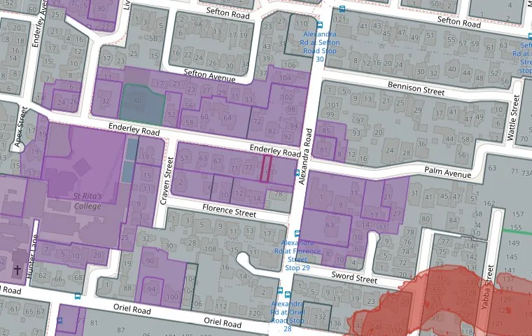
Property Report
For anyone buying, building or renovating. A free interactive map preview first, then a $9 PDF covering zoning, flood, bushfire, heritage and environmental overlays, water, sewer and stormwater with recorded pipe depths, plus how often and how low aircraft fly over the address.
- Planning report $9 - about 24 pages
- + Terrain Report $9 - contours, slope, interactive 3D model
- + Flood Model Report $9 - where a model is held
- No account needed - PDF in about 15 minutes
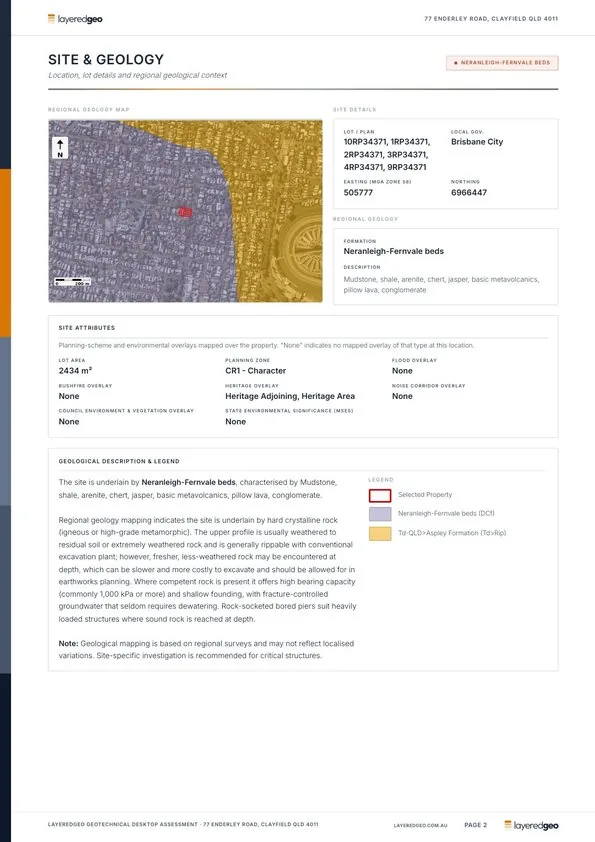
Geotechnical Desktop Study
For engineers, developers and builders scoping a site. A compiled desktop assessment of the ground beneath the address, from the same government sources the industry relies on.
- Geology, soils, reactivity and acid sulfate risk
- Groundwater and nearby bore logs
- Topography, cross sections and imagery
- QLD, NSW, VIC and SA

GIS / CAD Site Export
For designers and drafters. Current spatial layers clipped to the lot or a custom area and packaged for GIS or CAD, in one download.
- Cadastre, contours, DEM, TIN and watercourses
- Geology, soils and easements
- Planning, hazard and heritage overlays
- GeoPackage, Shapefile, DXF and raster outputs
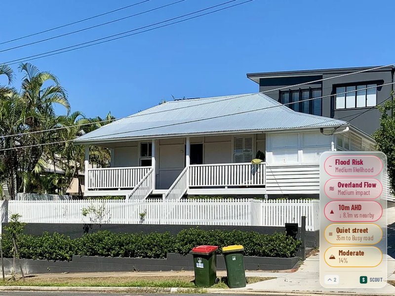
Scout
For anyone browsing listings. A Chrome extension that overlays flood, elevation, slope, road and price data on every realestate.com.au listing as you scroll.
- Flood risk and AHD elevation on the listing
- Price estimate on every property
- Heritage and bushfire screening
- Cancel any time
View full pricing → · Looking for a workflow-specific page? Browse use cases →
What you get
Real government data, drawn for one address
Pick a layer to see how it appears in a report. Every image is a real LayeredGeo output for a real lot.
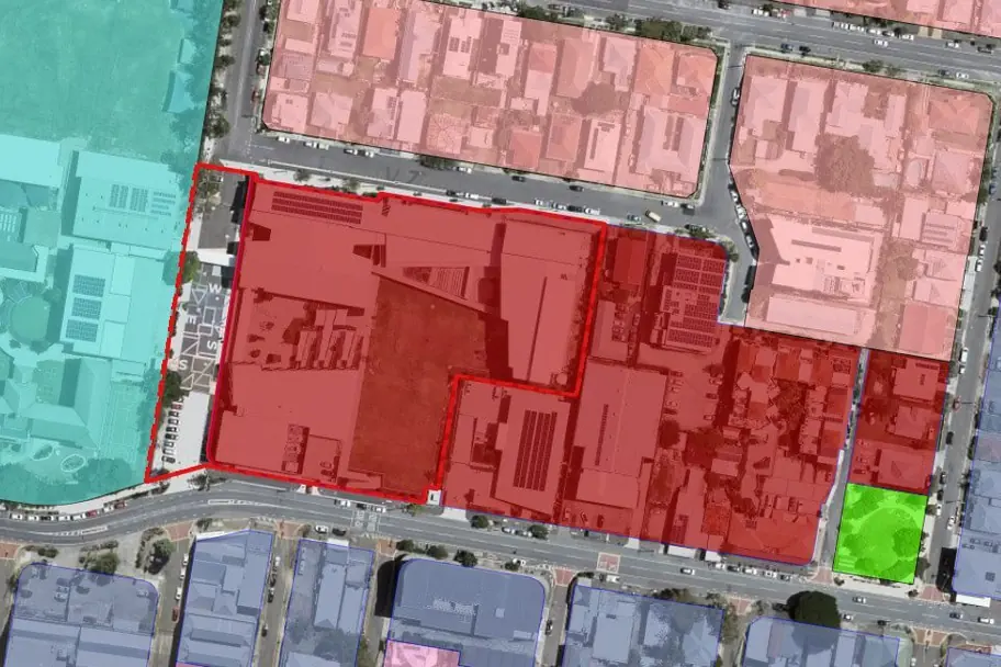
Zoning
The zone the lot sits in and the zones around it, from the council or state planning scheme, drawn to the cadastre.
- What can be built, and how big
- Neighbouring zones that shape the street
- In the Property Report and the GIS export
Flood overlays
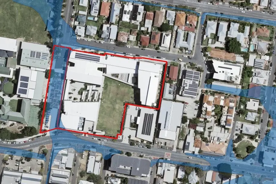
Every council and state flood map that touches the lot, with the part of the lot it covers. Read from 491 flood maps and studies from 130+ councils and agencies.
- Council flood planning areas and flood studies
- Recorded historic floods and storm tide
- In the Property Report and the GIS export
Heritage and character
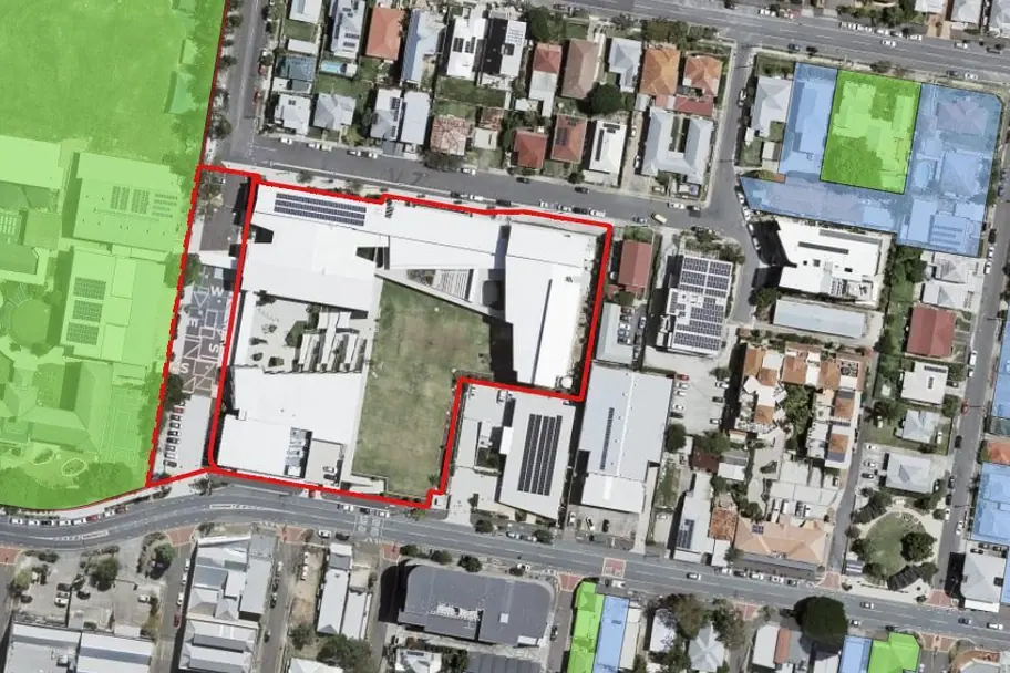
State and local heritage listings, character overlays and their buffers, so a renovation surprise shows up before contracts.
- State register and local heritage places
- Character and demolition-control overlays
- In the Property Report and the GIS export
Flood depth model
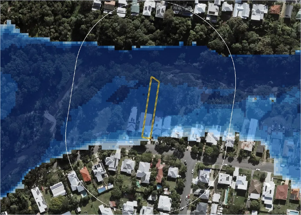
Where a published flood study covers the address, the modelled depth, velocity and flood level at the lot for every event the study holds.
- Depth on the lot, event by event
- Flood level against ground level
- The Flood Model Report, $9 on its own or with the Property Report

Utilities and pipe depths
Water, sewer, stormwater and power mapped around the lot from the utility's own network data, with the recorded depth or invert level of the nearest sewer and stormwater mains where the utility publishes it.
- Which mains run through or beside the lot
- Recorded invert levels in metres AHD
- In the Property Report, $9
Terrain and slope
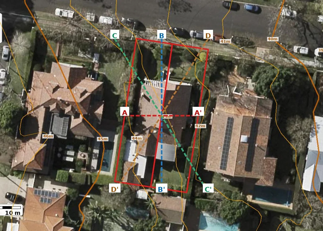
Contours, cross sections along and across the lot, boundary profiles, driveway grade, a slope and aspect map and a 3D model to spin round in your browser, read from the state elevation model. Try the sample 3D model.
- Which way the block falls, and by how much
- Driveway grade against the published standard
- The Terrain Report, $9 on its own or as a section of the Property Report, or the GIS export
Geology and soils
Mapped geology, soil order, reactivity, acid sulfate risk, groundwater and nearby bore logs, compiled into a desktop study.
- What the ground is likely to be, and how deep
- Nearby bore logs and water levels
- The Geotechnical Desktop Study, $119
Site data for every property decision across six states
LayeredGeo turns authoritative state and federal datasets into ready-to-use site information for any address in Queensland, New South Wales, Victoria, South Australia, Tasmania and the ACT. Whether you need a geotechnical desktop study, raw GIS layers for design, or a planning overlay check, you get the same trusted government sources used across the industry - compiled in minutes instead of days. See how we compile the data.
Geotechnical engineers
Desktop geology, soils, acid sulfate and borehole context to scope investigations and inform site classifications.
For geotechnical engineers →Civil engineers
Contours, watercourses, elevation and cadastre exported straight into your CAD or GIS for early design.
For civil engineers →Property developers
Screen sites fast for flood, zoning, heritage and environmental constraints before you commit.
For property developers →Town planners
Instant planning overlay maps and reports covering zoning, overlays and regulatory constraints across QLD, NSW, VIC, SA, TAS & ACT.
For town planners →Buying a property?
Check the planning overlays, the flood modelling and the slope of a block before you bid or sign. Start with the $9 Property Report and add flood model or terrain at checkout.
See what a property report covers →Common uses: site due diligence · pre-purchase site review · geotechnical desktop study · browse all use cases
Explore planning constraints by suburb
See how flood, bushfire, heritage and zoning overlays fall across QLD, NSW, VIC, SA, TAS and the ACT - a free planning profile and schematic for every suburb, no address needed.
Latest articles
How to read a section 10.7 certificate for ground hazards NSW
A step-by-step walkthrough of reading a NSW section 10.7 planning certificate for acid sulfate soils, landslip, filled land and flood before you buy.
27 September 2026Landslip hazard in Tasmania: council map vs report
Comparing three ways to check landslip hazard on a Tasmanian block: the LIST hazard map, a council certificate and a desktop report before you buy.
24 September 2026Form 1 and site conditions in SA: 7 geotech mistakes
Seven mistakes buyers and builders make with soil, fill and reactive clay before a soil test in South Australia, and what a Form 1 does not tell you.
Common questions
The Property Report is $9 for the planning report; the terrain section and the flood model section (where a published model is held) are $9 each, ticked at checkout - $18 with one section, $25 with both. Geotechnical reports are $119 each, GIS data exports from $15, and Scout is a $15/month subscription. All prices include GST. See the full pricing page for packs and monthly plans.
No - purchased report and export credits never expire. Buy them when it suits you and use them at your own pace. Monthly agency and export plans are different: their allowance tops up each month and unused allowance does not roll over.
Geotechnical reports, GIS exports and property reports each use their own credit type, all managed from a single LayeredGeo account. One property report credit covers a planning, flood model or terrain report, and a report with added sections uses two. Scout is a separate monthly subscription.
Planning reports and GIS export cover any address in Queensland, New South Wales, Victoria, South Australia, Tasmania and the ACT; geotechnical reports cover Queensland, New South Wales, Victoria and South Australia. Every product draws on authoritative state and federal government datasets for that location.
Most reports and exports are generated in just a few minutes and delivered as an instant download (reports are also emailed to you).
Yes - every price shown includes GST. No surprises at checkout.
Ready to get started?
Pull authoritative planning, flood, terrain, geotechnical and GIS data for your site in minutes - property reports and GIS export across six states, geotechnical reports for QLD, NSW, VIC and SA.