Simple, transparent pricing
Pay per report, per export, or per planning check. No lock-in - credits never expire and are shared across all three professional tools.

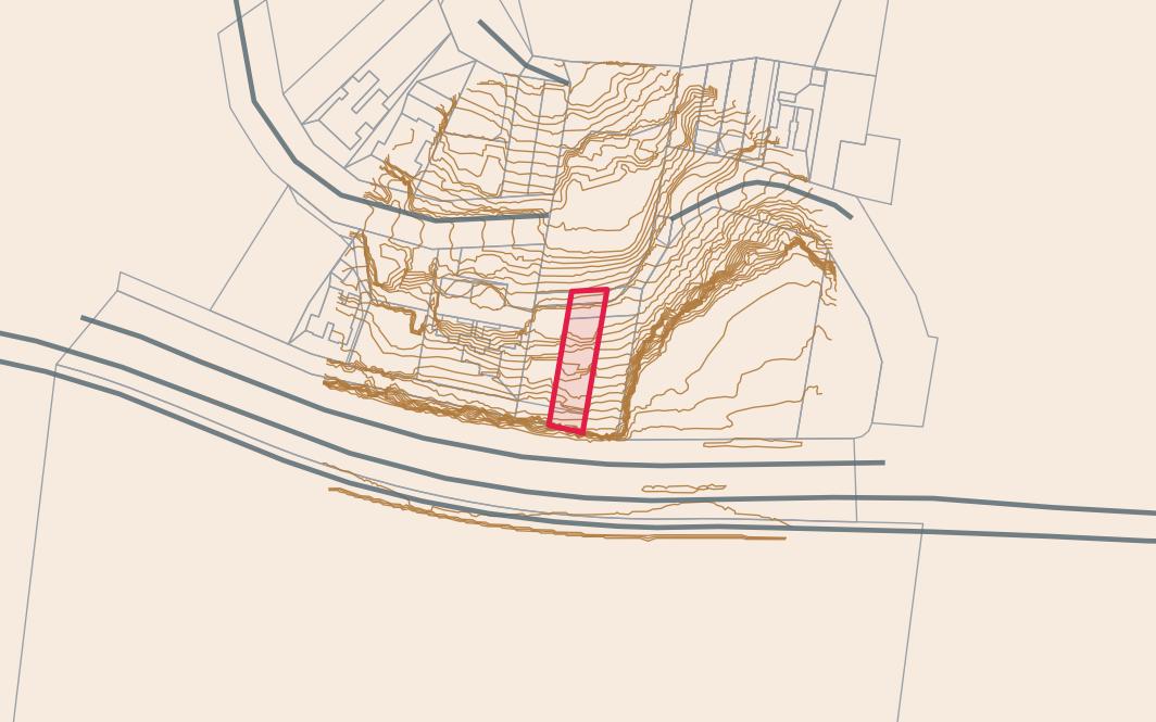
Geotechnical Reports
LayeredGeo account · pay per use
Geotechnical Reports
Geology, soils, groundwater, topography and borehole data for any QLD or NSW address.
- PDF report with 20+ data layers
- QLD & NSW coverage
- Ready in minutes
- Credits never expire
GIS Data Export
LayeredGeo account · pay per use
Spatial Data
Download raw spatial layers for any address - ready for Civil 3D, QGIS, ArcGIS and Google Earth.
- DXF, Shapefile, GeoPackage & KMZ
- Geology, soils, contours & DEM
- GDA2020 / GDA94 / WGS84
- Business subscriptions available
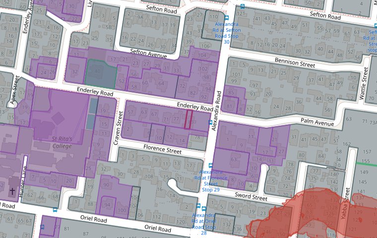
Planning Maps
LayeredGeo account · pay per use
Planning Overlays
Instant planning overlay maps for any QLD or NSW address - zoning, flood, bushfire, heritage and more.
- Free interactive map preview
- QLD & NSW ePlanning data
- PDF report with all overlays
- Flat $9 - no subscription
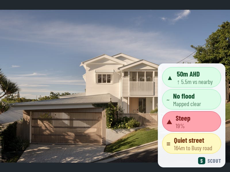
Property Browsing
Direct Stripe subscription
Scout
A Chrome extension that overlays flood, elevation, terrain, road and price-estimate data on every realestate.com.au listing as you browse.
- Flood risk & AHD elevation
- Price estimate on every listing
- Heritage & bushfire screening
- Cancel anytime
LayeredGeo Account
For Reports, GIS Export & Planning Maps
- Sign up with email and password
- Buy credits and use them across all three products
- Credits never expire
- Manage your account at layeredgeo.com.au/account
Scout Subscription
For the Scout Chrome Extension
- No LayeredGeo account or password required
- Subscribe directly through Stripe
- API key emailed after payment - paste into the extension
- Cancel or manage billing via the Stripe customer portal
Not sure which product?
Our products are designed to be used together - professionals use the reports and GIS exports, property buyers use Scout.